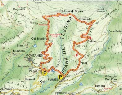
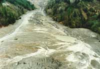
This trail passes round the area affected by the landslip which began October 30, 1960 when about 1 million cubic metres of material started to move.
The southern slope of Mount Teverone is made up of cretaceous limestone of the Fadalto formation, highly permeable due to its cracks and karst structure. This rock dips steeply to the south where a fault brings it into contact with impermeable tertiary rock, covered almost completely by a layer of calcareous rubble. The underground water runs southward as far as the main slope of the slip where it wells up in several springs. Here the Eocene Flysch surfaces, highly folded and fractured, having been squashed between two faults.
Geological features of this kind ensure the landslip is in continuous movement even if not at a constant rate. It was most noticeable in December 1962 and November 1963 when the gap created reached 500 metres in width and the mudflow 60 metres in depth. Further smaller movements were recorded up till 1992.
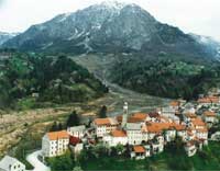
In the Spring of 1992 about 500,000 cubic metres of material started to move on the left side of the valley, extending the mudflow towards the village of Lamosano and raising its height near the village of Funes.
To reduce the quantity of water which affected the area a drainage tunnel was built, 1,300 metres long and with a 13 square metre section, inside the layer of Fadalto limestone. A further series of slightly inclined drains inside Mount Teverone increased the drainage capacity. This operation was completed in the Spring of 1996.
The flow of water collected in this system at present averages 150 l/sec and is used in local water supplies.
Distortions caused to the landscape, damage to the vegetation and its subsequent adaptation (bent trees and pioneering plants on exposed earth) can all be seen on the walk.
Farming activities have also been damaged, with meadows abandonned for years.
An embankment near the village of Funes has deviated the mud flow.